Providing commercial and private aerial imaging services, including ground mapping and 3D structural modeling.
Advanced Ground Mapping and 3D Modeling Solutions
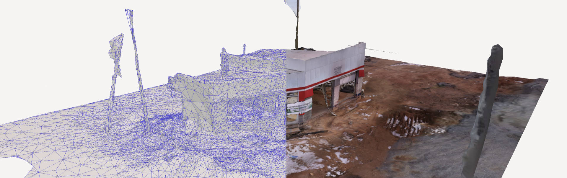
We offer advanced ground mapping and 3D modeling services to provide precise and actionable insights. These services are invaluable for construction site management, development planning, and environmental studies. Our team uses cutting-edge technology to produce highly detailed maps and accurate 3D models that architects, engineers, and planners rely on to streamline their projects. Turn complex data into clear, actionable visuals.
Stunning Visuals with Aerial Drone Photography
We specialize in delivering high-quality aerial photography and videography services. Using state-of-the-art drones, we capture breathtaking visuals from unique angles and heights, providing a fresh perspective that enhances marketing campaigns, showcases properties, and documents important projects. From real estate to construction and event coverage, our aerial imagery elevates your storytelling and planning.
Tailored Services for Home and Property Projects
We also work with private individuals to bring their home and property projects to life. Whether you’re selling your home, designing a dream landscape, or planning renovations, our aerial and ground-based services are tailored to fit your needs. Imagine a bird’s-eye view of your property to highlight its unique features or a comprehensive 3D model to guide your vision. Our team collaborates with you to ensure your goals are met with precision and creativity.
Drone Services:
We provide a full range of aerial and ground-based services, including:
- Aerial Drone Photography and Videography – Capturing stunning visuals from above for marketing, events, and more.
- Ground Mapping – Delivering precise property layouts and landscape overviews.
- 2D Orthomosaic Maps – Improving communication, planning construction phases, record keeping, progress monitoring, and sharing project updates.
- 3D Modeling – Creating detailed, interactive models for planning and development.
- Photogrammetry Models – interpreting photographic images and patterns
- Real Estate Showcase – Highlighting homes and properties for sales or promotions.
- Construction Site Monitoring – Documenting progress and offering insights for efficient management.
- Event Coverage – Capturing dynamic aerial views for personal and professional events.